The Spanish Road
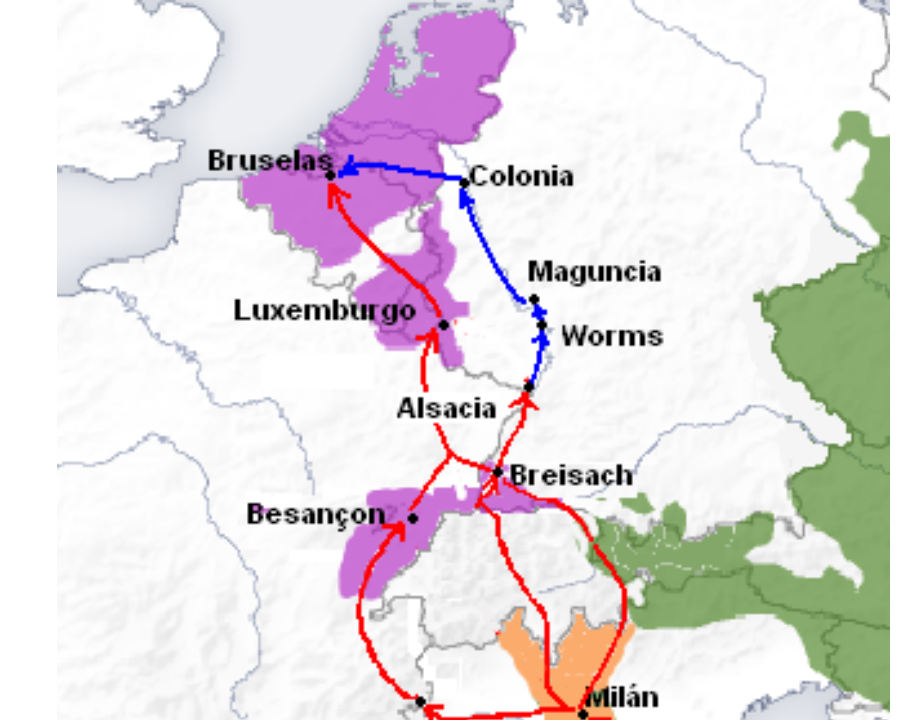
As we studied last Wednesday, Charles I inherited a lot of territories in different parts of Europe. France continued to be the Hispanic Monarchy´s main enemy and it was difficult to keep all the territories connected. During Philip II´s rule a route was established to connect the Iberian Penindula (through the Aragonese ports of Valencia and Catalonia) with the North of Italy and the Low Countries. This route was known as the Spanish Road and it was used for trade, but also for military supply, especially during the Revolt of the Low Countries (1568-1648). This road was safer than the sea route which linked the Cantabrian ports of Castile with the Low Countries.
If you want to learn more about this road, please click on the following link:
There is a classical history book about this road written by Geoffrey Parker in 1972: The Army of Flanders and the Spanish Road (1567-1659). Here you have a small review:
The cover of The Army of Flanders and the Spanish Road (1567-1659) reproduces the Dutch Lion (Leo Belgicus), a map of the Low Countries drawn in the shape of a lion. This map was drawn for the first time in 1584, during the revolt of the Low Countries against Philip II´s authoritarianism. It symbolized the Dutch resistance against the king. The map included the territories of present Belgium and Hollans. Here you have more information about this strange map:
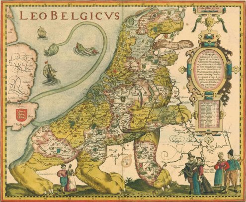
The Dutch Lion
No comments:
Post a Comment